Road Closures
Maps
Katoomba Road Closures
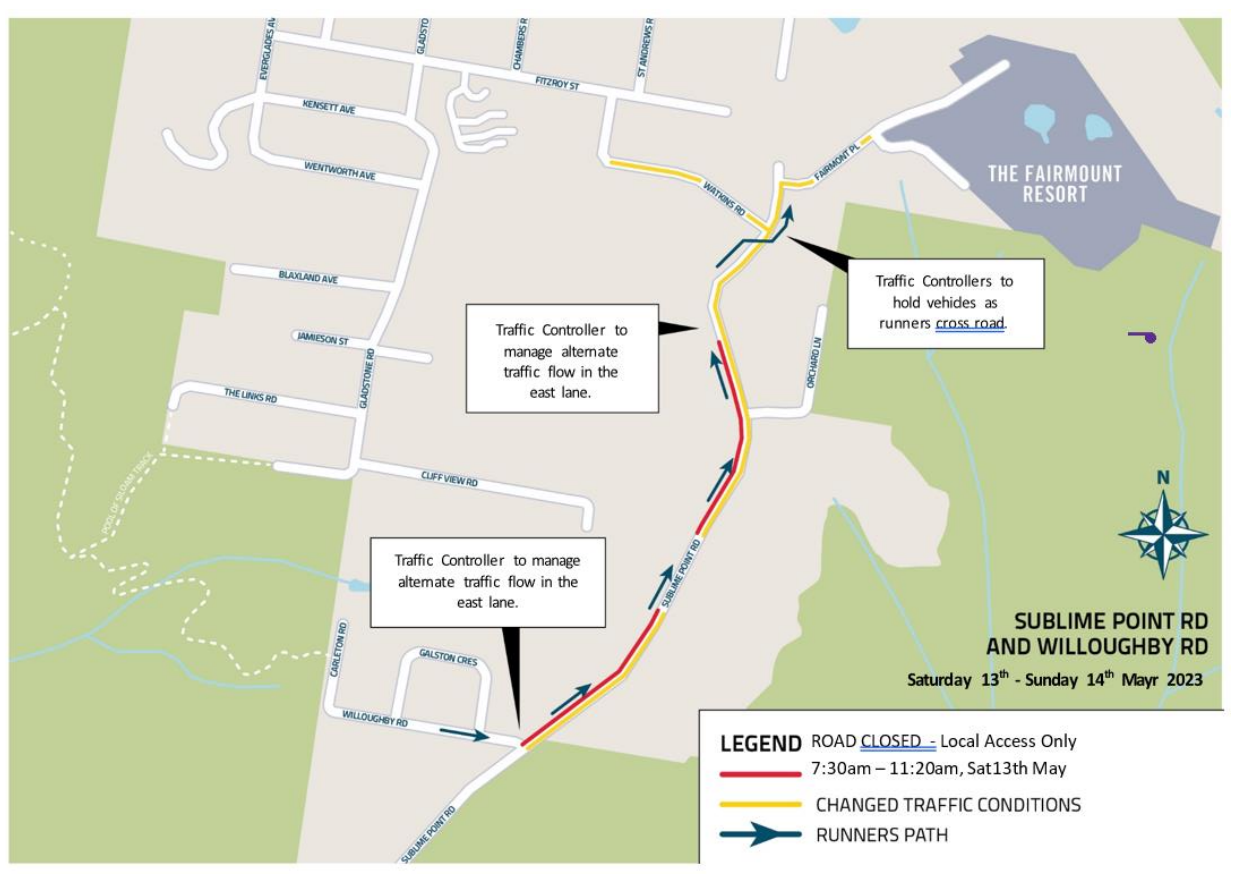
Leura Road Closures
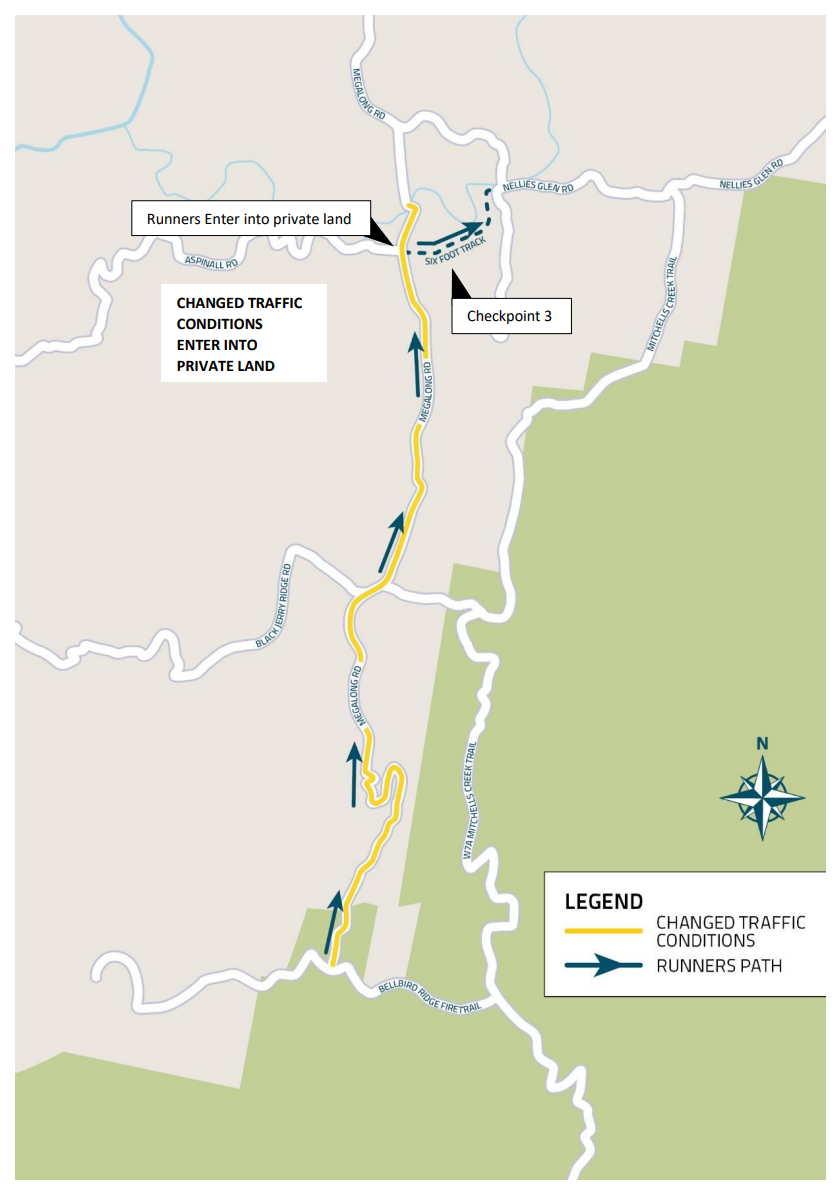
Megalong Valley Changed Traffic Conditions
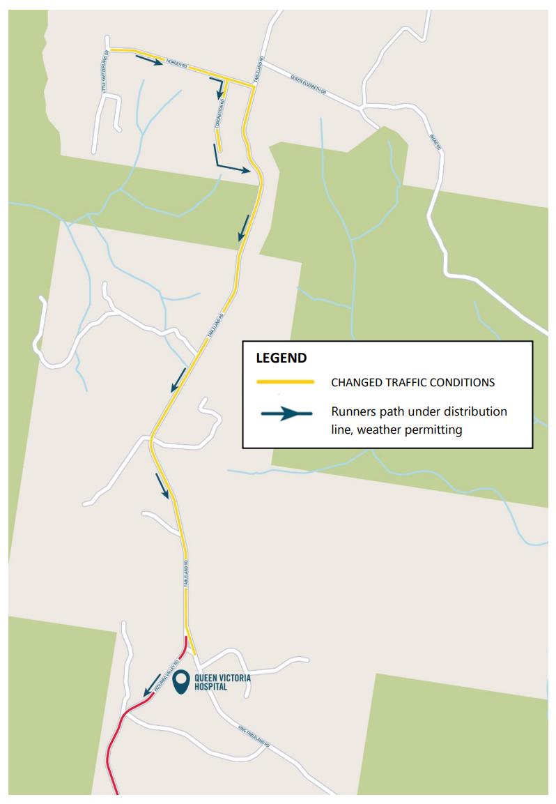
Wentworth Falls Changed Traffic Conditions
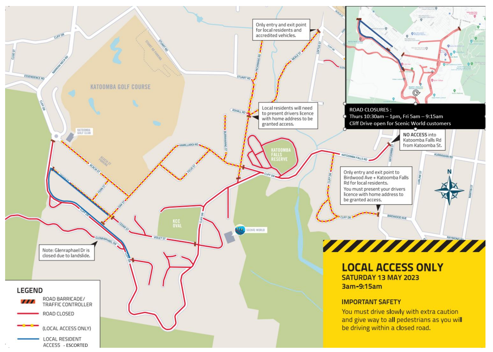
With thousands of runners descending on Katoomba, some road and track closures will be necessary across the event week.
The maps above show the Saturday morning road closures on the streets surrounding Scenic World so the event precinct can be completely sealed off from vehicles. The outer perimeter of the event precinct is formed by road closures at Narrow Neck Road & Cliff Drive, 59 Stuarts Road, Neale Street & Loftus Street, Katoomba Street & Katoomba Falls Road and Katoomba Street & Birdwood Avenue.
The roads surrounding Scenic World will be open to traffic at all other times. Visit the transport services page for information on how to get to Scenic World on Saturday morning.